




Agba News


Benue News
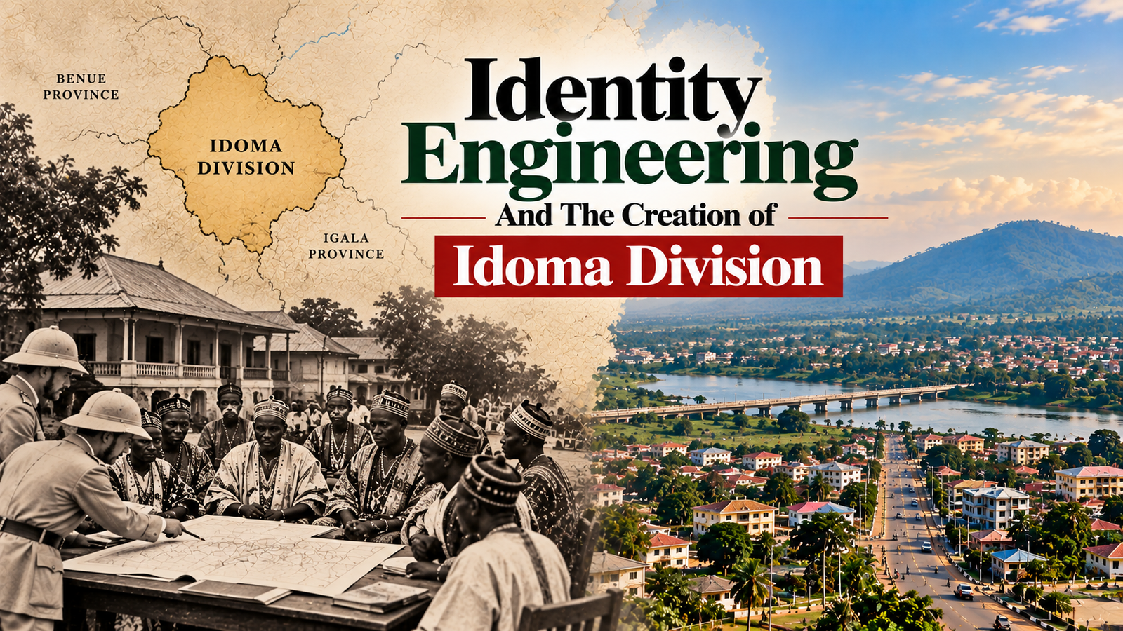
Identity Engineering And The Creation of Idoma Division.
Before British colonial administrators established a unified political structure over the territory now widely recognised as Idomaland, the Lower Benue region was home to numerous tribes with their own languages, traditional institutions, ancestral histories and systems of governance.
The Akpoto, associated with the Idoma-speaking population, were among these communities.
So were the Igede, Akweya and Ufia, whose cultural and linguistic identities were distinguishable from those of their neighbours.
Although these communities interacted through trade, migration, marriage and other relationships, they were not all governed by one paramount traditional ruler or institution.
Through territorial reorganisation, Native Authority institutions and the consolidation of traditional political leadership, the British brought different communities into a common administrative system.
The process eventually contributed to the emergence of the modern Idoma political structure, culminating in the establishment of the Och’Idoma institution in 1947.
But there was a fundamental problem, because being placed within the same colonial administrative division did not necessarily mean that the communities involved considered themselves one ethnic nationality.
For the Igede people in particular, historical accounts say they objected to incorporation into an administrative structure that did not reflect their separate language, cultural traditions and political identity.
To understand the origins of these disagreements, we must return to the colonial restructuring of the Lower Benue region during the early twentieth century.
Before Idoma Division: The Lower Benue Was Home to Distinct Tribes
The history of the Idoma people did not begin with British colonial administration.
Idoma-speaking communities had existed for generations before colonial officers established formal divisions and Native Authorities.
Likewise, the Igede, Akweya and Ufia tribes possessed their own histories long before they were brought under shared colonial institutions.
What changed during the colonial period was not the existence of these peoples, but the administrative relationship between them.
The Akpoto: An Older Name Associated With Core Idoma Communities
The name Akpoto appears in historical discussions of the peoples inhabiting parts of the Lower Benue region.
Some historical traditions and earlier accounts associate Akpoto with communities later identified as the core Idoma-speaking population today.
The Igede: A Distinct People of the Cross River–Benue Frontier
The Igede people predominantly inhabit present-day Oju and Obi Local Government Areas of Benue State.
Their language, known as Igede.
Igede tribe also maintain their own cultural traditions, indigenous political institutions and historical narratives.
Their geographical location near the Cross River–Benue frontier placed them within an area where colonial administrative boundaries underwent significant changes.
Igede historical accounts describe earlier administrative connections with the Abakaliki–Ogoja axis before incorporation into the northern administrative system.
This background is central to understanding why the Igede question became an important issue in the development of Idoma Division.
The Akweya: The People of Akpa
The Akweya, also known as Akpa, are another distinct ethnolinguistic tribe within the wider territory historically administered as Idomaland.
Their language and cultural identity are distinguishable from those of the core Idoma-speaking population.
The colonial administrative system placed Akweya communities within a wider political arrangement that increasingly came to be identified with Idoma.
Nevertheless, administrative membership did not eliminate their separate identity.
The Ufia: The Utonkon Tribe
The Ufia people, associated with the Utonkon area, also possess a distinct linguistic and cultural heritage.
Like the Akweya and Igede, they became part of a larger administrative structure during colonial rule.
The historical importance of these communities lies in their diversity.
The British were not simply combining villages that already shared one central political institution.
They were constructing a common administrative framework across populations with different histories and traditions.
Why the British Wanted a Unified Administrative Structure
British colonial government depended heavily on territorial divisions, local councils, recognised chiefs and Native Authorities.
These institutions helped colonial officials administer extensive territories with relatively few European personnel.
In Northern Nigeria, Indirect Rule frequently operated through established emirate systems.
But the Lower Benue presented a different political environment.
There was no single traditional ruler whose authority was universally recognised by all the communities later included within Idoma Division.
Administrative Convenience and Colonial Control
The British sought institutions capable of performing several functions:
- Collecting taxes and other government revenues.
- Administering Native Courts.
- Enforcing colonial regulations.
- Maintaining local order.
- Coordinating communication between communities and colonial officers.
- Organising public works and local government responsibilities.
A larger administrative division could reduce the number of separate institutions requiring direct colonial supervision.
However, what appeared administratively convenient to British officials would create political difficulties for the tribes involved.
A district head recognised by colonial government might not possess traditional authority over neighbouring communities.
Similarly, an administrative name applied to a large territory might not accurately represent the identities of all its inhabitants.
This tension would become one of the defining features of the Idoma administrative experiment.
1918–1923: The Foundations of Idoma Division
The creation of Idoma Division is sometimes presented as a single event that occurred in 1922.
The historical record, however, suggests a more gradual process.
Several administrative adjustments took place between 1918 and 1928, involving Okpoga, Otukpo, Ankpa and neighbouring districts.
These changes helped establish the territorial framework that later became Idoma Division.
1918: The Transfer of Okpoga Division
Colonial administrative histories record the transfer of Okpoga Division into the northern provincial administration in 1918.
This was an important stage in the reorganisation of territories along the northern–southern administrative frontier.
Okpoga subsequently became closely associated with the development of Idoma administration.
1922: The Egede–Ukelle Frontier Expedition
Another significant event occurred in 1922.
A colonial administrative account refers to the Egede–Ukelle expedition, which extended British administrative control over the frontier and helped establish boundaries between the Northern and Southern Provinces.
This development is particularly important to Igede history.
It places the incorporation of the Igede frontier within the broader process of colonial territorial consolidation.
The event also demonstrates that the political geography of the area was still being actively reorganised after the 1914 amalgamation.
1923: The Formation of Idoma Division
One historical administrative account identifies 1923 as the year when northern districts were separated from Igala administration to form Idoma Division.
This differs slightly from accounts that give 1922 as the founding year.
The difference may reflect the distinction between initial administrative arrangements and subsequent formal consolidation.
For historical accuracy, the creation of Idoma Division is therefore best understood as a process spanning the early 1920s rather than a single universally established date.
1924–1928: Otukpo, the Railway and the Consolidation of Idoma Administration
The location of administrative headquarters was a major consideration in British colonial government.
Transportation networks influenced where officials could travel, communicate and supervise districts.
Otukpo’s growing importance was closely connected to the railway.
Why Otukpo Became the Administrative Headquarters
Historical administrative records identify 1924 as an important year in the establishment of Otukpo as the headquarters of Idoma Division.
Its railway connection made the town strategically valuable.
Government correspondence, personnel movement and commercial activities could be coordinated more easily from a transport-connected centre.
For British officials, Otukpo offered advantages that many smaller settlements could not provide.
But concentrating administration in Otukpo also had political consequences.
Communities farther away became increasingly dependent on institutions based outside their traditional territories.
1927: The Idoma Central Native Council
In 1927, the colonial administration approved the Idoma Central Native Council.
This was an important stage in the development of the wider Native Authority structure.
The council provided a framework for coordinating district leadership and local administration.
The historical account refers to this development as the establishment of the Idoma Native Authority.
A distinction is necessary, however, between the approval of the central council and the later evolution of the broader Native Authority system.
The institutions developed over time rather than appearing in their final form overnight.
1928: The Administrative Structure Becomes More Consolidated
Further reorganisation occurred in 1928, including the incorporation of Okpoga Division into the wider Idoma administrative arrangement.
By this stage, the colonial authorities had moved considerably closer to their objective of establishing a unified system.
The resulting political structure brought together communities that had previously been governed through different districts and administrative arrangements.
Key dates in the creation of Idoma Division
| Year | Historical development |
|---|---|
| 1918 | Okpoga Division transferred into northern administration |
| 1922 | Egede–Ukelle frontier expedition and administrative consolidation |
| 1923 | Formation of Idoma Division from northern districts |
| 1924 | Otukpo established as divisional headquarters |
| 1927 | Formal approval of the Idoma Central Native Council |
| 1928 | Further consolidation involving Okpoga Division |
| 1947 | Emergence of Chief Ogiri Oko as the first Och’Idoma |
Four Tribes, One Colonial Administration And The Question of Identity
The political significance of Idoma Division becomes clearer when we examine the different tribes incorporated into the administrative system.
The historical account identifies four important ethnolinguistic populations.
| Community | Identity | Colonial political relationship |
|---|---|---|
| Akpoto / core Idoma | Associated with the principal Idoma-speaking population | Formed an important part of the emerging Idoma political structure |
| Igede | Distinct Igede-speaking nationality | Incorporated into the wider northern administrative system |
| Akweya / Akpa | Distinct Akweya-speaking communities | Administered within the wider Idoma territorial framework |
| Ufia / Utonkon | Distinct Ufia-speaking communities | Included within the broader colonial administrative arrangement |
This classification illustrates the diversity of the territory.
Did the British Create the Idoma Ethnic Identity?
This question requires an important historical distinction.
The British did not create the Idoma people or their language.
Idoma-speaking communities existed before colonial rule, with their own historical traditions and identities.
What colonial administration helped create was a more centralised political structure that brought different communities under institutions identified with the Idoma name which was not originally associated with theses people prior to this era.
The distinction is essential because the colonial government did not invent the existence of the Idoma people, but it helped institutionalise a wider Idoma administrative and political framework.
That framework sometimes included communities that did not identify ethnically as Idoma.
The consequences were and still particularly important for the Igede people.
The Igede Agitations And Why Political Incorporation Became Controversial
According to the history, Igede leaders objected to being incorporated into the wider Idoma Native Authority.
The account describes their objections as rooted in language, culture, political autonomy and historical administrative relationships.
For the Igede, the central issue was not necessarily opposition to neighbouring peoples.
It was the question of whether their own community should be governed through institutions identified primarily with another ethnic nationality.
1. Linguistic Distinctiveness
The Igede language and that of Idoma are not same
Language is an important marker of identity, especially where communities maintain distinct oral traditions, customary expressions and cultural institutions.
From this perspective, political incorporation raised concerns about the recognition of Igede as a separate people.
2. Traditional Political Autonomy
Igede people possessed indigenous institutions before colonial rule.
Their systems of leadership and customary authority developed within their own historical environment.
The creation of a larger Native Authority could therefore be viewed as a reduction of local political independence thus the historical account show they demand for a separate Igede administrative structure as one expression of this concern.
3. Historical Connections With the Southern Frontier
Igede historical traditions preserve relationships with the Ogoja–Obudu and Abakaliki areas.
The colonial restructuring of the frontier altered the administrative context within which those relationships existed.
For communities whose cultural and geographical connections extended southwards, incorporation into northern administration could represent a significant political change.
4. Representation Within the New Institutions
The creation of a common administrative council raised questions about the distribution of authority.
Who would appoint or recognise local leaders?
How would different communities be represented?
Would one political identity become dominant within the wider administration?
These questions were not unique to Igede.
They appeared in different forms throughout colonial Nigeria whenever separate communities were placed under shared institutions.
Did the British Ignore Igede Objections?
The historical account maintains that Igede objections were disregarded by British colonial officials.
It attributes this decision to the colonial government’s preference for administrative convenience.
According to that interpretation, the British were unwilling to establish a separate Igede Native Authority because doing so would complicate their territorial arrangements.
The Idoma Hope Rising Union and the Rise of Political Organisation
As colonial Nigeria moved towards constitutional reform and eventual independence, educated elites increasingly formed associations to advance communal interests.
The Idoma Hope Rising Union, commonly abbreviated as IHRU, became associated with efforts to strengthen Idoma political organisation and recognition.
The Objectives of Elite-Led Associations
Associations of this kind frequently sought to promote:
- Educational advancement.
- Greater participation in colonial administration.
- Recognition of traditional institutions.
- Community development.
- Political coordination among districts.
- Stronger representation within regional government.
For Idoma political elites, centralisation could provide advantages in negotiations with colonial authorities and other political groups.
However, the same process could generate concerns among smaller communities included within the wider administrative territory.
The question was whether a stronger central institution could adequately recognise the identities and interests of all its constituent populations.
1947: The Establishment of the Och’Idoma Stool
The emergence of the Och’Idoma institution in 1947 marked a major development in the political history of the region.
Chief Ogiri Oko became the first Och’Idoma, establishing a central traditional leadership institution that would become increasingly significant in the decades that followed.
Before this development, the wider administrative territory had been governed through a combination of district-level leadership and colonial councils.
The new paramount institution represented a further step towards political centralisation.
What the New Institution Represented
For supporters, the Och’Idoma institution offered a symbol of unity and a stronger traditional voice.
It also provided a recognised central authority through which Idoma interests could be represented.
For communities with separate traditional identities, however, the emergence of a paramount institution raised questions about the relationship between central authority and local autonomy.
The history of the stool must therefore be understood within the broader political transformation of the Lower Benue region.
Independence and the Political Legacy of Idoma Division
Nigeria gained independence in 1960, but the administrative structures established during colonial rule continued to influence political organisation.
The former Idoma territory became part of the Northern Region of independent Nigeria.
In 1967, the creation of Benue-Plateau State introduced another administrative arrangement.
In 1976, Benue State was established.
The Igede, Idoma and other tribes of the region became part of the new state.
The Emergence of Benue South
Today, the principal Igede homeland is located in Oju and Obi Local Government Areas.
These local governments belong to Benue South Senatorial District, alongside several other local government areas associated with the wider Idoma political territory.
This modern electoral arrangement reflects the long historical relationship between communities brought together through colonial administration.
But it does not erase their separate ethnic identities.
Igede Political Identity in Contemporary Benue State
The Igede people continue to maintain a distinct language, culture and sense of communal identity.
Their political participation takes place through local government institutions, the Benue State government and the Nigerian federation.
Questions of representation, development and recognition remain important within this framework.
For those examining Igede political history, the colonial period provides essential background.
It explains how the present administrative arrangement developed and why historical identity continues to matter in discussions about the future.
Was the Creation of Idoma Division a Political Success or a Source of Lasting Tension?
The answer depends partly on whose historical experience is being considered.
From the perspective of colonial administrators, a consolidated division provided a more manageable framework for governing the region.
For supporters of Idoma political unity, the creation of central institutions helped strengthen representation and traditional leadership.
For communities concerned about their distinct identities, however, the same arrangement could create fears of political absorption or inadequate recognition.
Finally, Lesson for Nigerian Federalism
The history of Idoma Division illustrates a recurring problem in Nigerian political development.
Colonial authorities frequently established administrative boundaries that combined communities with different identities.
After independence, many of these boundaries survived within regions, states, local governments and electoral constituencies.
Consequently, questions first raised during colonial administration sometimes remained relevant long after British rule ended.
The challenge for modern Nigeria is to ensure that shared political institutions provide fair representation without requiring communities to abandon their distinct identities.
Cross River News
Nigeria News

Evolution of Southern Nigeria From 1900 to Date
The map of Nigeria we recognise today was not drawn in a single day. It emerged from more than a century of colonial conquest, administrative experiments, political negotiations, regional rivalries and demands for self-government.
Before Nigeria became a federation of 36 states and the Federal Capital Territory, the southern half of the country had passed through several transformations. Vast territories were merged, divided into provinces, reorganised into regions and eventually broken into states.
Behind these changing boundaries were communities whose political identities, traditional institutions and relationships with neighbouring peoples were profoundly affected.
To understand the evolution of Southern Nigeria from 1900 to the present, we must return to the beginning of British territorial consolidation and examine how a collection of independent societies became part of a modern nation.
1900: The Birth of the Southern Nigeria Protectorate
At the beginning of the twentieth century, the territory now known as Nigeria was not administered as one political entity.
British influence had expanded through commercial treaties, military expeditions and agreements with local rulers. By 1900, London was reorganising its possessions along the Niger and the Atlantic coast.
On 1 January 1900, the British established the Southern Nigeria Protectorate by combining the former Niger Coast Protectorate with territories previously administered by the Royal Niger Company south of Lokoja.
The new protectorate included extensive territories along the Niger Delta, the Cross River basin and the eastern hinterland.
Lagos, however, remained a separate British colony.
The Three British Administrations in 1900
The territories that would eventually form Nigeria were divided into three principal administrations:
- Northern Nigeria Protectorate: Covering much of the northern interior, including the territories of several emirates and Middle Belt communities.
- Southern Nigeria Protectorate: Covering the Niger Delta, eastern territories and parts of the southern interior.
- Lagos Colony and Protectorate: Administered separately, including Lagos and territories in the western hinterland.
These boundaries were primarily instruments of British imperial administration rather than expressions of a shared Nigerian national identity.
For the peoples living within them, older political relationships, kingdoms, village confederacies and trading networks continued to exist alongside expanding colonial authority.
The 1900 reorganisation therefore marked an important stage in British consolidation, but it did not yet create Nigeria as a unified country.
1906: Walter Egerton and the Three Great Provinces of Southern Nigeria
A major turning point occurred on 1 May 1906, when the British merged Lagos with the Southern Nigeria Protectorate.
The merger was overseen by Sir Walter Egerton, who had held responsibilities for both Lagos and Southern Nigeria before the consolidation.
The newly enlarged Colony and Protectorate of Southern Nigeria was organised into three major administrative provinces: Western, Central and Eastern.
The three provinces of Southern Nigeria, 1906
| Province | Headquarters | Principal territories |
| Western | Lagos | Lagos and the Yoruba hinterland, including Ibadan, Oyo, Abeokuta and Ondo areas |
| Central | Warri | Benin, Warri, Niger Delta communities and parts of the lower Niger basin |
| Eastern | Calabar | Cross River territories, Igbo hinterlands and eastern coastal communities |
Why the Three-Province Structure Became Difficult to Govern
The territories assigned to these provinces were enormous.
The Eastern Province, administered from Calabar, encompassed communities with different languages, political institutions, cultural traditions and systems of leadership.
The Central Province similarly covered diverse Niger Delta and inland societies whose political structures differed considerably.
The challenge was particularly pronounced in communities where political authority was distributed among councils of elders, lineage heads, age grades and village assemblies.
Unlike some northern emirates, many southern societies did not possess a single paramount ruler through whom the British could conveniently administer an entire territory.
This difference became a central issue in the development of Indirect Rule in Nigeria.
1914: Lord Lugard and the Amalgamation of Nigeria
On 1 January 1914, the British amalgamated Northern and Southern Nigeria under one colonial government.
Sir Frederick Lugard became Governor-General of the newly constituted Colony and Protectorate of Nigeria.
The amalgamation remains one of the most consequential decisions in Nigerian colonial history.
It brought hundreds of communities, kingdoms and ethnic nationalities under a common political administration, despite their different historical experiences.
Why Did Britain Amalgamate Northern and Southern Nigeria?
The decision was influenced by several considerations.
- Financial administration: Southern revenues, especially customs receipts, could help support the financially weaker northern administration.
- Transport coordination: Railways, waterways and other infrastructure could be managed within a common framework.
- Administrative efficiency: The British sought to reduce duplication and coordinate government departments.
- Imperial control: A unified administration strengthened British authority over the territories.
Economic considerations were especially important. The British wanted a more financially sustainable colonial possession without maintaining entirely separate systems for the north and south.
The amalgamation did not, however, immediately erase the administrative distinctions between Northern and Southern Nigeria.
They continued to operate as major territorial groupings within the new colonial structure.
1914–1915: From Three Macro-Provinces to Smaller Colonial Provinces
Alongside the amalgamation came further efforts to reorganise territorial administration.
The broad provincial arrangement inherited from the Egerton era gave way to a more elaborate system of smaller administrative units.
The objective was to bring colonial government closer to communities, strengthen supervision of district officers and make local administration more manageable.
In the historical account, nine southern provinces are identified with this reorganisation:
- Ogoja
- Calabar
- Onitsha
- Owerri
- Benin
- Warri
- Oyo
- Abeokuta
- Ijebu
These names are important in tracing the subsequent administrative history of Southern Nigeria.
The nine-province list should be treated as a reconstruction of the early provincial reorganisation rather than a conclusively verified list of nine provinces all established on one date in 1914. Colonial provincial boundaries and names changed over time, and the precise sequence requires comparison with contemporary government gazettes and administrative reports.
How Provincial Administration Supported Indirect Rule
The new administrative arrangements gave British officers greater opportunities to supervise communities through local institutions.
In territories with established kingship systems, colonial officials frequently governed through recognised traditional rulers.
In other communities, especially parts of southeastern Nigeria, colonial authorities appointed warrant chiefs and created Native Authorities or councils.
These institutions helped enforce colonial regulations, administer courts and organise taxation.
But their introduction also generated opposition.
In many societies, colonial-appointed officials exercised powers that did not correspond to traditional political customs.
Consequently, the expansion of Indirect Rule was not merely an administrative reform. It changed local political relationships and sometimes created new forms of authority that survived beyond colonial rule.
1939: Southern Nigeria Is Reorganised Into Eastern and Western Provinces
Another major administrative transformation occurred in April 1939.
The British reorganised the Southern Provinces into two larger territorial administrations: the Eastern Provinces and the Western Provinces.
Enugu became the administrative headquarters of the Eastern Provinces, while Ibadan served as headquarters of the Western Provinces.
This arrangement was an important step towards the regional political structure that would emerge in the final decades of colonial rule.
The reorganisation did not mean that smaller provinces disappeared. Rather, they continued to exist within larger administrative groupings.
The Political Importance of the 1939 Reorganisation
The division reinforced the growing administrative distinction between eastern and western Nigeria.
Over time, political movements, educational institutions, commercial interests and regional organisations developed within these broad territories.
The consequences became increasingly visible as Nigerians demanded greater participation in government.
Colonial boundaries that had initially been designed for British convenience were gradually becoming the geographical foundations of Nigerian political competition.
1946–1954: From Colonial Provinces to Political Regions
The next major stage in Nigeria’s constitutional development came with the Richards Constitution of 1946.
It introduced a regional framework that recognised three major territorial divisions: Northern, Western and Eastern Nigeria.
Although the constitution preserved substantial colonial authority, it provided an institutional basis for regional representation.
The Macpherson Constitution of 1951 expanded Nigerian participation in government and strengthened regional institutions.
In 1954, the Lyttleton Constitution established a more explicitly federal constitutional arrangement.
The Rise of Regional Politics
The three major regions became increasingly important centres of political activity.
Political parties developed strong regional bases, while demands for autonomy and constitutional reform gathered momentum.
But the regional system also exposed a serious political problem.
Many minority communities feared that independence under large regional governments would leave them permanently dominated by more populous groups.
These concerns were especially pronounced in parts of the Eastern and Northern Regions.
1960–1963: Independence and the Four-Region Federation
On 1 October 1960, Nigeria gained independence from Britain.
The new country inherited the regional political structure developed during the final years of colonial administration.
At independence, Nigeria consisted of three regions:
- Northern Region
- Western Region
- Eastern Region
Lagos served as the federal capital.
In 1963, the Mid-Western Region was created from the Western Region, bringing the number of regions to four.
This development was particularly significant because it demonstrated that Nigeria’s internal boundaries could be altered through constitutional political processes after independence.
However, many minority communities remained within the larger regions, and demands for additional territorial autonomy continued.
1967: The End of the Regional System and the Creation of 12 States
The most dramatic restructuring of Nigeria’s internal political map occurred on 27 May 1967.
The military government of General Yakubu Gowon abolished the four-region structure and replaced it with 12 states.
This decision came during a period of severe political crisis and shortly before the Nigerian Civil War.
The restructuring weakened the former regional power centres and established smaller administrative units.
The Twelve States Created in 1967
| State | General territorial origin |
|---|---|
| North-Western | Northern Region |
| North-Central | Northern Region |
| Kano | Northern Region |
| North-Eastern | Northern Region |
| Benue-Plateau | Northern Region |
| Kwara | Northern Region |
| Western | Western Region |
| Lagos | Western Region and federal territory |
| Mid-Western | Mid-Western Region |
| East-Central | Eastern Region |
| Rivers | Eastern Region |
| South-Eastern | Eastern Region |
1976: Nigeria Expands to 19 States
Under the military administration of General Murtala Mohammed, Nigeria was reorganised into 19 states.
Benue State emerged from the former Benue-Plateau State, establishing a new administrative framework for communities including the Tiv, Idoma, Igede and other groups.
Cross River State also emerged from the former South-Eastern State.
1987: Nigeria Expands to 21 States
The military government of General Ibrahim Babangida created Akwa Ibom and Katsina States.
This increased the total to 21.
1991: Nigeria Expands to 30 States
Nine additional states were created, including Abia, Enugu, Delta, Edo, Jigawa, Kebbi, Kogi, Osun and Yobe.
The restructuring further altered the political geography of the old southern provinces.
1996: Nigeria Reaches 36 States
Under General Sani Abacha, six additional states were created:
- Bayelsa
- Ebonyi
- Ekiti
- Gombe
- Nasarawa
- Zamfara
Southern Nigeria Today: From Colonial Provinces to 17 States
In contemporary Nigeria, the territory commonly described as Southern Nigeria consists of 17 states distributed across three geopolitical zones.
| Geopolitical zone | States |
|---|---|
| South-West | Lagos, Ogun, Oyo, Osun, Ondo, Ekiti |
| South-East | Abia, Anambra, Ebonyi, Enugu, Imo |
| South-South | Akwa Ibom, Bayelsa, Cross River, Delta, Edo, Rivers |
These geopolitical zones are not the same as the provinces established by the British.
They represent a much later system of geographical classification used in Nigeria’s political and administrative life.
Nevertheless, traces of older colonial boundaries remain visible.
Cities such as Calabar, Warri, Benin, Abeokuta, Onitsha, Owerri and Ogoja continue to carry historical significance beyond their present administrative status.
The Unfinished Legacy of Colonial Boundaries
More than a century after the establishment of the Southern Nigeria Protectorate, questions surrounding territorial identity and political representation remain relevant.
Nigeria’s state creation exercises addressed some minority demands, but they did not resolve every historical grievance.
In several communities, arguments for greater political autonomy continue to draw upon memories of colonial provinces, traditional territories and earlier administrative arrangements.

Entertainment
Politics

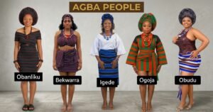
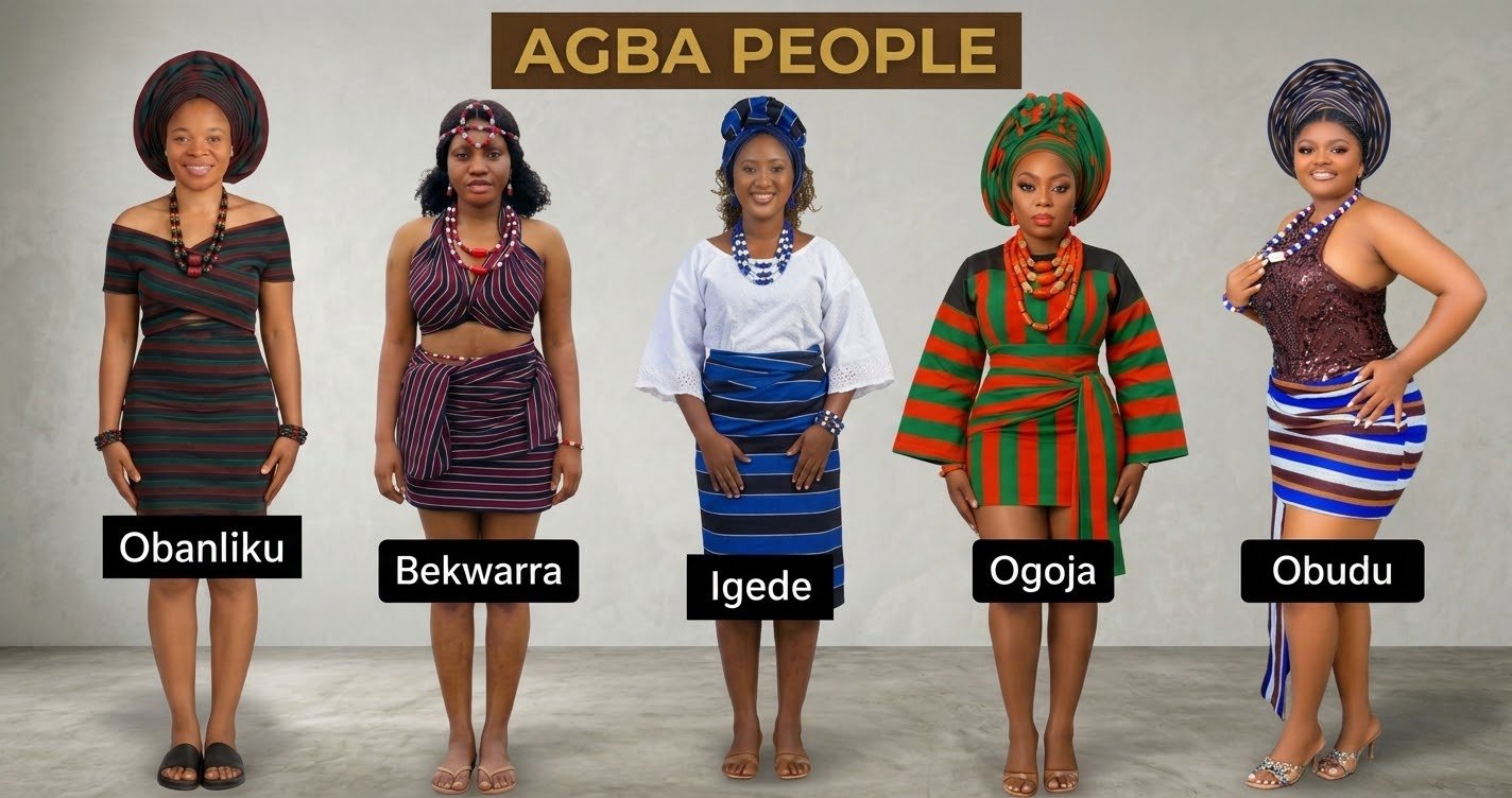
Celebrating the Rich Cultural Heritage of the Agba People Across Benue and Cross River
Culture remains one of the strongest foundations of community identity. Across Northern Cross River State and the Igede-speaking communities of Benue State, cultural traditions continue to shape social relationships, family life, celebrations, and the transmission of knowledge between generations.
The Agba identity, as represented by Agba Voice, provides an opportunity to explore the historical, linguistic, and cultural connections among communities within this regional coverage area.
While these communities possess distinct local traditions, their shared interest in cultural preservation creates opportunities for cooperation and mutual understanding.
Language as a Living Heritage
Indigenous languages are more than instruments of communication. They preserve histories, expressions, traditional knowledge, and the unique ways communities understand their surroundings.
For younger generations growing up in increasingly urban and digital environments, maintaining connections with ancestral languages can be challenging.
English and Nigerian Pidgin dominate many public conversations, while indigenous languages may receive less attention in formal education and digital media.
Families, cultural associations, and community educators can support language preservation through storytelling, local publications, recordings, and educational programmes.
Digital platforms also offer opportunities to document traditional expressions and make cultural knowledge accessible to future generations.
Traditional Celebrations and Community Identity
Cultural festivals, traditional dances, marriage ceremonies, and community gatherings remain important expressions of heritage.
These occasions provide opportunities for families to reconnect, communities to celebrate their identities, and younger people to learn about traditional customs.
They can also support local businesses, including food vendors, fashion designers, musicians, photographers, and craftspeople.
Documenting these events responsibly helps preserve their significance beyond the communities where they take place.
Preserving Culture in a Changing World
Modernisation does not necessarily require communities to abandon their traditions.
Instead, cultural preservation can exist alongside education, technology, entrepreneurship, and changing lifestyles.
Young people can contribute by recording oral histories, interviewing elders, documenting festivals, and creating educational content in indigenous languages.
Agba Voice intends to provide a platform where such stories can reach wider audiences.
By celebrating cultural diversity and documenting community heritage, the platform hopes to strengthen connections between generations while introducing the region’s traditions to readers across Nigeria and beyond.